Introduction To The Ha Giang Loop
Why do so many travelers to Vietnam mention the term “Ha Giang loop”? Once you know about it, you will understand the excitement about exploring the Ha Giang Loop, one of Vietnam’s most breathtaking journeys. Indeed, the Ha Giang Loop map reveals a stunning motorbike route through northern Vietnam’s highlands, rich with vibrant ethnic cultures, spectacular mountain vistas, and winding roads carved along towering cliffs.
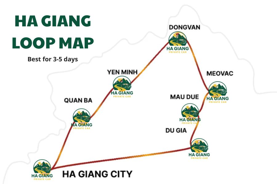
This loop is a mix of adventure, culture, and natural beauty. It opens varied experiences for travelers. Covering roughly 300 kilometers, the loop typically includes stops at Quan Ba, Yen Minh, Dong Van, and Meo Vac, making it manageable within 3 to 5 days depending on your pace.
This journey rewards you with landscapes like the Twin Mountains at Quan Ba, the dramatic Ma Pi Leng Pass, and peaceful ethnic villages. Despite planning a quick 3-day Ha Giang loop map route or a more relaxed 4-day itinerary, you should have a clear route map to maximize your experience and ensure you don’t miss key highlights.
All in all, the Ha Giang Loop Vietnam map is essential for navigating mountain roads and planning your daily distances thoughtfully. So, Ha Giang Private Car will walk you through all you need to know about Ha Giang Loop journeys. Let’s go.
Planning Your Ha Giang Loop Trip
When To Visit Ha Giang Loop?
The best time to visit the Ha Giang Loop is in two key periods: from September to November and from March to May. During these months, the weather is generally mild and pleasant with daytime temperatures ranging from around 15°C to 28°C (59°F to 82°F).
The skies are often clear and sunny, making for excellent visibility and safer riding conditions on the mountainous roads. In particular:
🍂 From September to November: Ha Giang enters its autumn season, which locals call the “Golden Season.” The terraced rice fields turn a stunning golden color as they near harvest. Thus, you can admire impressive landscapes that add a unique charm to your journey.
Moreover, cooler temperatures and lower rainfall make the roads less slippery and easier to navigate. This period also offers opportunities to experience local harvest festivals, providing cultural richness alongside the scenic beauty.
🌸 From March to May: In spring, the weather remains mild with moderate rainfall. This season ushers in fresh greenery and blooming flowers. So the region is filled with vibrant colors.
While occasional showers may occur, they are typically brief and do not disrupt travel extensively. Spring brings a refreshing atmosphere with mild temperatures that are comfortable for extended outdoor exploration.
❌ In contrast, the rainy season from June to August brings frequent heavy downpours, thunderstorms, and high humidity. Rain can make the mountain roads slippery and hazardous. You may face the risk of accidents and landslides, especially on steep passes like Bac Sum and Ma Pi Leng. Visibility may also be reduced due to fog and mist during this time.
Thus, planning your trip during the dry, moderate seasons of autumn or spring ensures safer travel, clearer views, and more enjoyable experiences.
How To Travel To Ha Giang Loop?
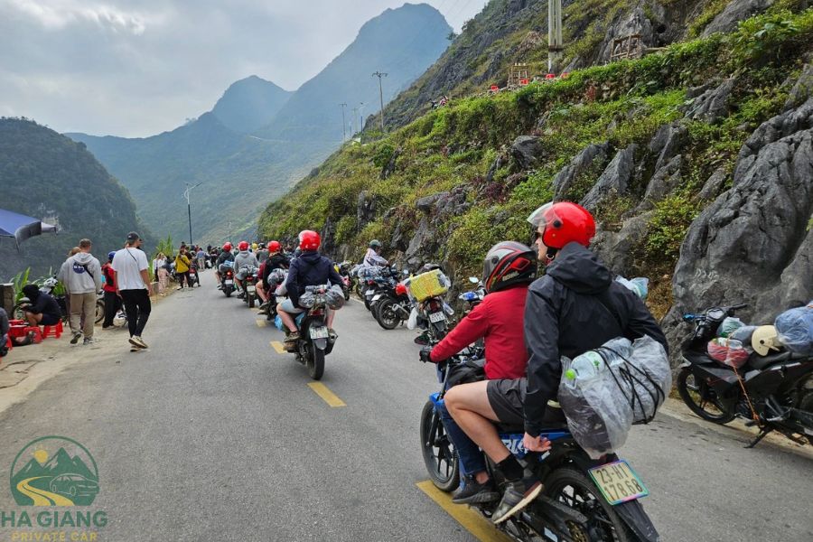
Getting to Ha Giang city is relatively easy with bus services from Hanoi or private transfers, taking roughly 6-8 hours.
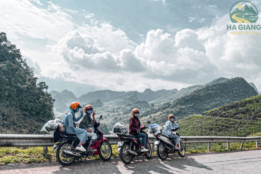
In Ha Giang, motorbike rental is the preferred way to explore the loop. But please remember, licenses and insurance are important. Please ensure you have a valid motorbike license and consider travel insurance that covers motorbike accidents. Rental shops often provide basic helmets and bikes suited for mountainous terrain.
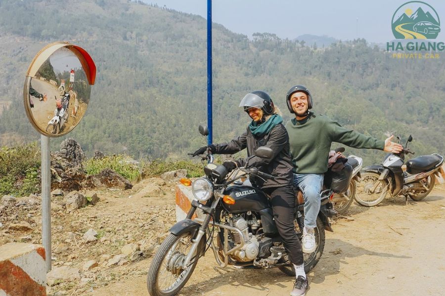
Furthermore, you can choose from guided tours, self-drive, or easy rider options. Each choice will suit a different purpose. For example:
- Guided tours provide safety and local knowledge.
- Self-driving offers freedom but requires confidence and experience.
- Easy riders allow you to relax while enjoying the ride with a local driver.
Each has pros and cons depending on your skills and preferences. Weigh the advantages and your own preferences to choose the right one.
Detailed Ha Giang Loop Route Map & Itineraries
The Ha Giang loop route map typically covers:
- Day 1: Ha Giang city to Quan Ba, passing Bac Sum Pass and Heaven’s Gate, then continuing to Yen Minh.
- Day 2: Yen Minh to Dong Van through scenic spots like Ma Pi Leng Pass and Lung Cu Flag Tower.
- Day 3: Dong Van to Meo Vac, including boat rides on the Nho Que River and other natural highlights.
- Optional Day 4-5: Extended itineraries explore local villages, waterfalls, and more cultural sites.
Here’s a simplified distance overview:
| Day | Route | Approximate Distance |
| 1 | Ha Giang – Quan Ba – Yen Minh | ~130 km |
| 2 | Yen Minh – Dong Van – Meo Vac | ~120 km |
| 3 | Meo Vac – Du Gia – Ha Giang | ~120 km |
| 4-5 | Cultural & natural site explorations | Varies |
Consider your travel needs to choose the most suitable itinerary for your Ha Giang Loop journey. It can be a compact 3-day Ha Giang loop map, the 4-day itinerary for a less rushed experience, or longer. No matter how many days, the Ha Giang loop tour map will always help you balance adventure and relaxation perfectly.
Top 8 Attractions And Landmarks Along The Ha Giang Loop
As you follow the Ha Giang Loop map, some landmarks and attractions stand out for their beauty and cultural significance. For those who are wondering which places to visit on their trip to Ha Giang loops, we introduce the list below.
It highlights essential spots you won’t want to miss while exploring the Ha Giang loop tour map. Each site offers a blend of awe-inspiring scenery and local culture that enriches your journey. Check them out to plan your adventure better.
Bac Sum Pass & Heaven’s Gate (Quan Ba)
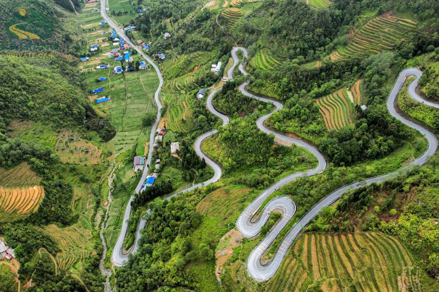
Bac Sum Pass, often called the “Majestic Road,” is the gateway leading you into the imposing landscapes of Ha Giang. Located at an altitude of around 450 meters on National Highway 4C, the pass offers a challenging yet rewarding drive. You can admire sweeping views of rugged cliffs and deep ravines.
Moreover, as you ascend, you’re greeted with panoramic vistas of the Tam Son Valley. It’s known for its lush rice terraces and ethnic villages.
And just beyond the pass, you’ll arrive at Heaven’s Gate, a dramatic viewpoint perched at approximately 1,500 meters. The gate frames the expansive landscape, with mist-covered mountains and verdant valleys stretching infinitely. It’s perfect for photography and awe-inspiring experiences.
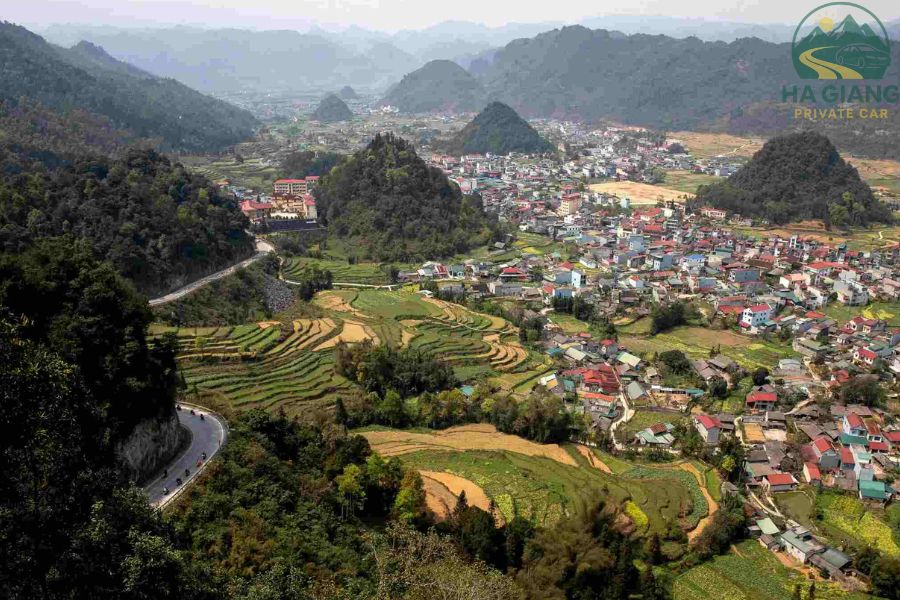
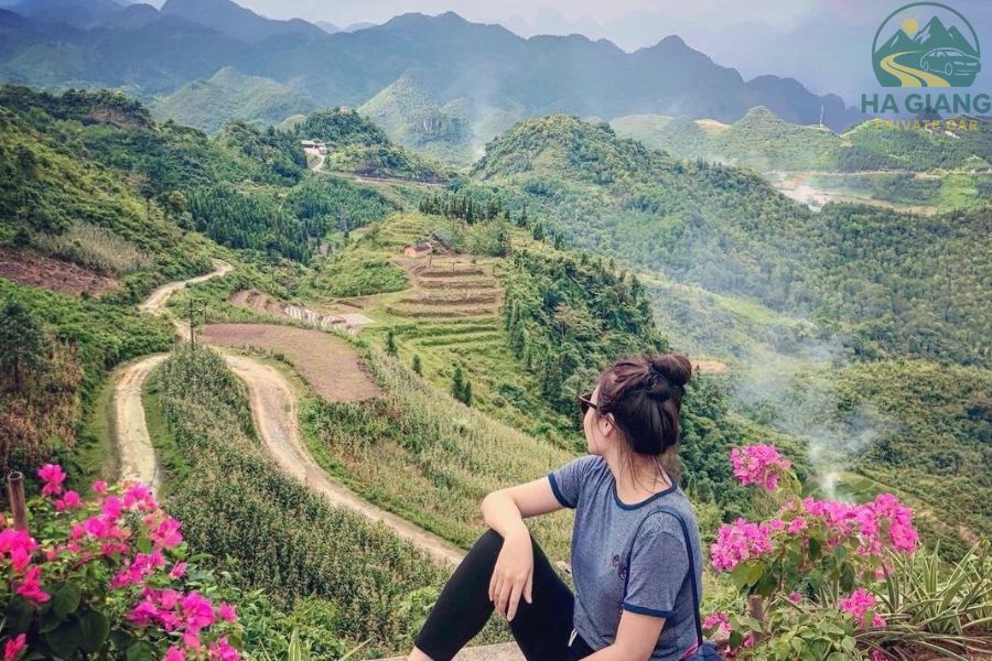
Twin Mountains Viewpoint
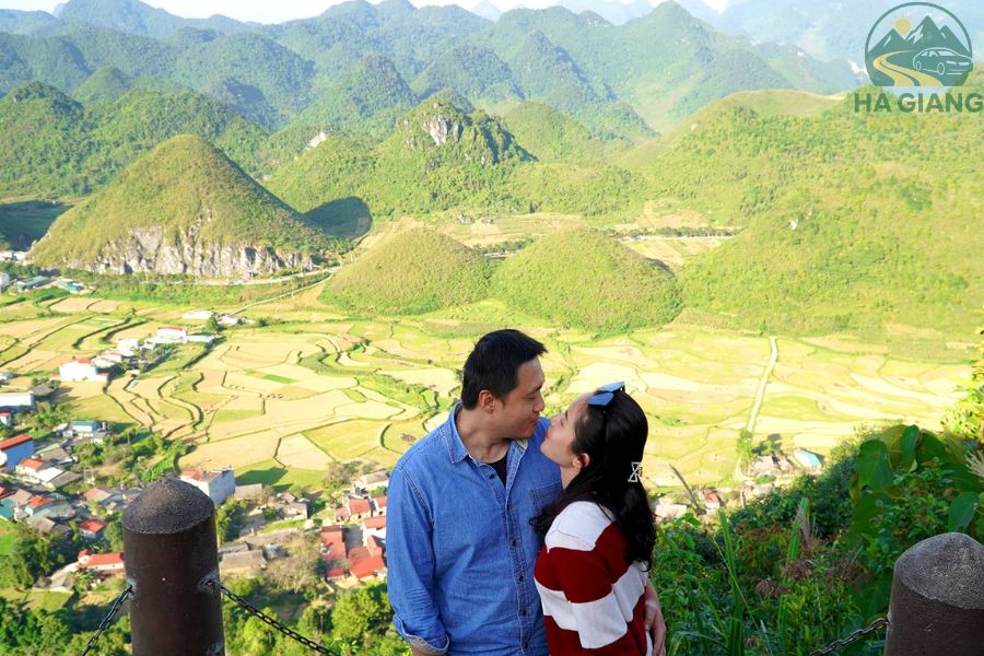
Known locally as the “Fairy Bosom,” the Twin Mountains are iconic limestone peaks situated near Quan Ba. These twin peaks have a distinctive, symmetrical shape. They resemble a woman’s bosom and have become a symbol of the Ha Giang region.
From the viewpoint near Quan Ba, travelers can gaze directly at these natural sculptures. They stand beautifully amidst lush green fields and forests. Most especially, the scenery is particularly captivating at sunrise or sunset when the peaks glow warmly under soft light.
On your Ha Giang loop trip, just come here to experience such excellent photo opportunities and a tranquil atmosphere. Visiting this site indeed provides a chance to immerse yourself in the region’s legendary and natural beauty.
Ethnic Minority Villages
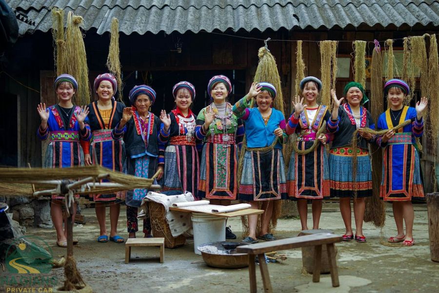
Lung Tam Weaving Village is a highlight for those interested in authentic cultural exploration. Home to the H’Mong and Dao people, this village offers visitors a glimpse into traditional textiles and crafts passed down through generations.
You can watch local women craft intricate embroidery and weaving. Interestingly, they often use handmade looms and natural dyes. Additionally, the village’s peaceful setting along mountain streams and rice paddies allows travelers to experience genuine rural life.
Interacting with friendly locals and purchasing handmade souvenirs promises to enrich your journey. It’s a lovely way to connect you to the region’s rich heritage and artisanal traditions.
Dong Van Ancient Town & Hmong King’s Palace
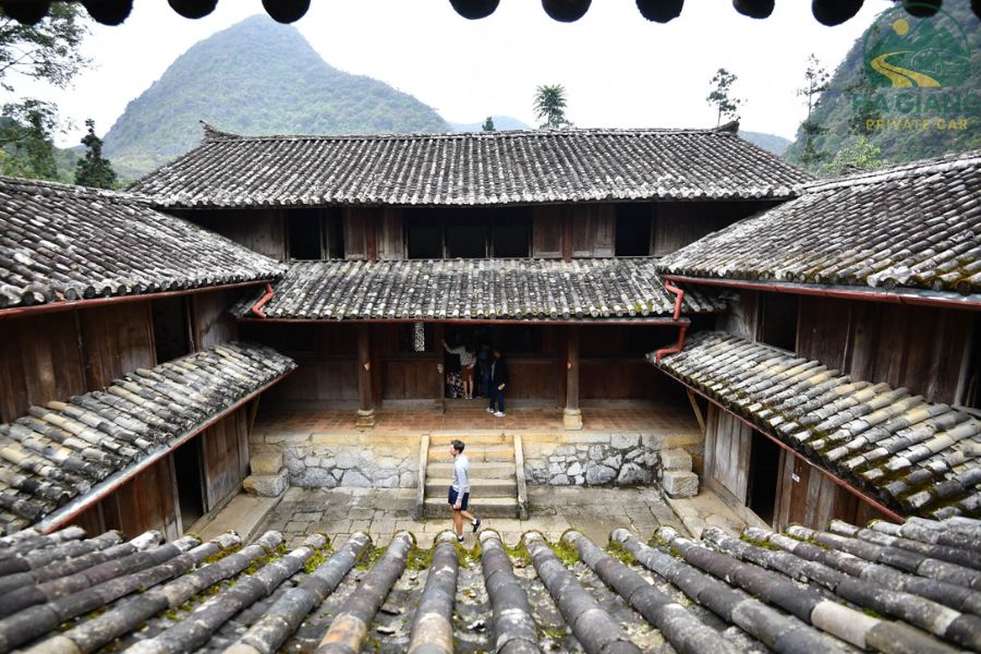
This well-preserved town is a living museum of history and architecture. As you stroll through narrow alleyways, you’ll see traditional old houses, bustling markets, and cafes.
The most prominent heritage site here is the Hmong King’s Palace. It was built in the early 20th century and stands as a symbol of local history and craftsmanship. Its intricate woodwork and design reflect the grandeur of H’Mong aristocracy.
Exploring Dong Van’s ancient streets reveals a deep cultural identity. You will see ethnic minorities wearing colorful traditional clothing, markets selling regional produce, and temples echoing stories of resilience.
It’s an ideal spot to learn about the region’s deep-rooted history and customs. So why not add it to your Ha Giang loop map?
Lung Cu Flag Tower
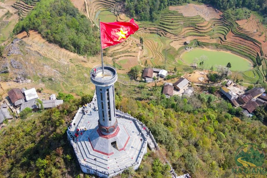
Lung Cu Flag Tower marks the northernmost point of Vietnam. It perches atop a hill at about 1,700 meters. Standing tall against the sky, the massive red flag flutters proudly over the border with China. What’s a view!
Moreover, the journey to Lung Cu offers sweeping panoramic views of the mountainous border region. Travelers can appreciate the terraced fields and distant villages dotting the landscape.
Upon arrival at the site, visitors can walk around the tower, take photos of the flag against the vast sky, and enjoy scenic vistas in every direction. The place also features cultural exhibits and traditional performances, giving travelers a deeper understanding of local history and the importance of national borders.
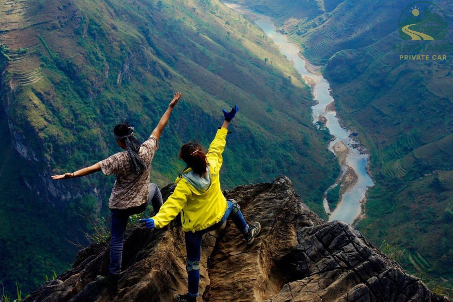
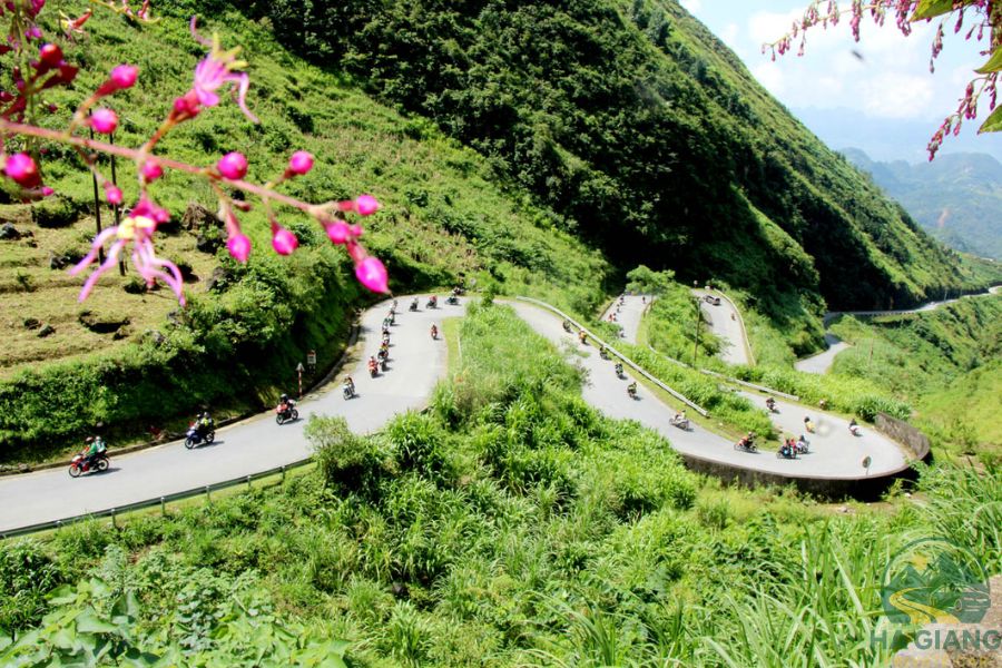
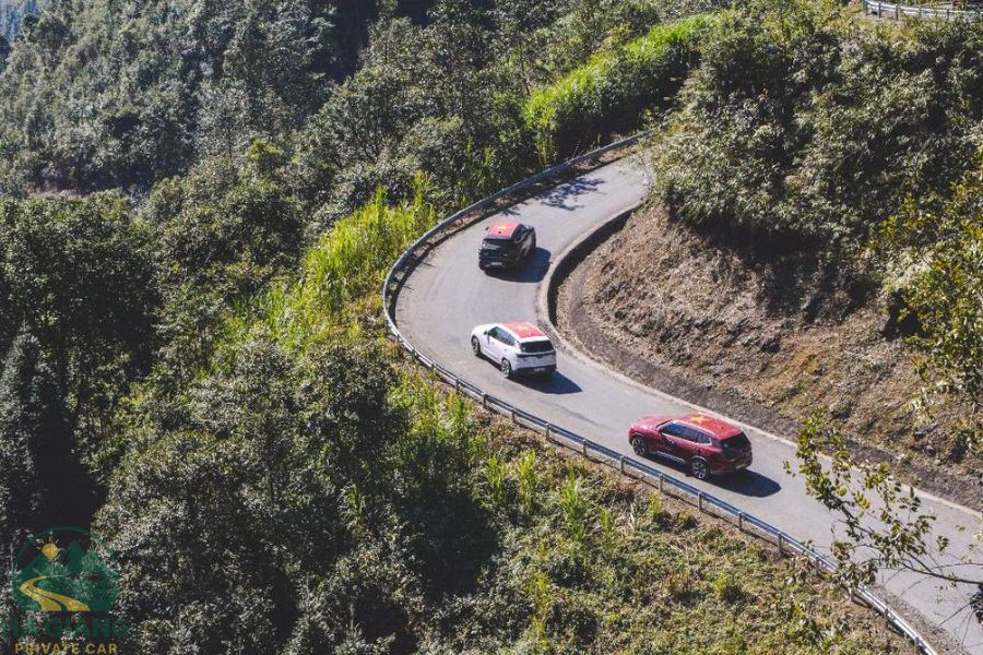
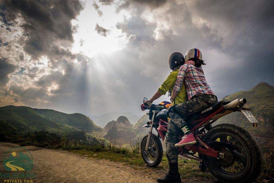
Ma Pi Leng Pass & Skywalk
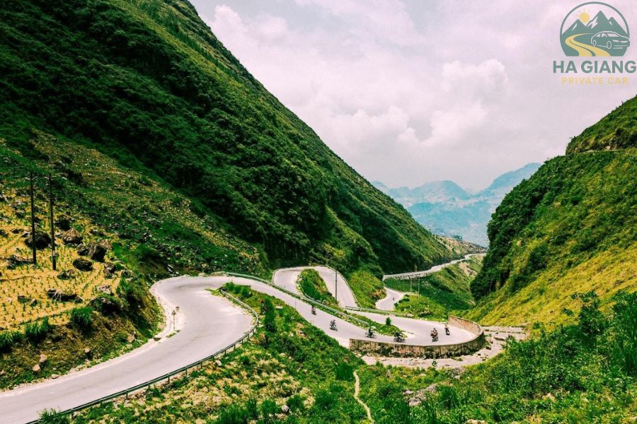
Ma Pi Leng, often deemed the most spectacular mountain pass in Vietnam, offers a dramatic ride along cliffs plunging into the Nho Que River below. The road twists and turns through towering limestone mountains, challenging riders but rewarding them with jaw-dropping views.
Besides, on this route, you will see the Skywalk. It’s a glass bridge along the edge of the cliff that provides an adrenaline-pumping perspective of the canyon and river below. Walking on the transparent floor reveals the river winding through the deep gorge.
Therefore, it’s considered a highlight for thrill-seekers and photographers alike. The pass embodies the rugged beauty and engineering marvels of the region.
Boat Ride On Nho Que River
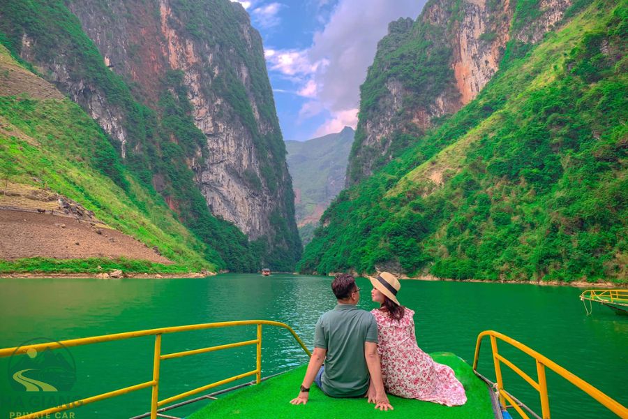
On your Ha Giang loop voyage, why not stop for a while at Nho Que River? Taking a boat along the Nho Que River promises an immersive encounter with nature’s raw power. The river, carved through deep valleys and limestone cliffs, creates a stunning landscape of steep slopes and lush greenery.
A boat ride will give you a peaceful contrast to the mountain drives. So it allows travelers to absorb the scenery from a different perspective. Also, along the way, you might spot local fishermen, minority villages on the riverbanks, and wildlife.
Imagine the calm waters reflect the towering cliffs. It will open many superb photo opportunities and moments of tranquility amid the adventure.
Du Gia Waterfall
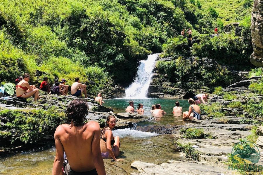
Last but not least, visit to Du Gia Waterfall promises a refreshing retreat from mountain exploration. The cascading waters tumble down rocks into natural pools, inviting travelers to relax and cool off. Surrounded by green forests and mountain views, the waterfall creates a serene environment for picnics and photography.
Hikers can enjoy nearby trails that lead to more secluded spots of natural beauty or explore the surrounding countryside. It’s an idyllic stop to unwind and reconnect with nature, making it an essential part of your Ha Giang Loop experience.
Accommodation And Dining On The Ha Giang Loop
Accommodation along the Ha Giang Loop ranges from cozy homestays to budget hostels and modest hotels. Homestays provide a unique chance to experience local hospitality and cuisine intimately.
Recommended towns for overnight stays are Ha Giang city, Yen Minh, Dong Van, and Meo Vac. Each of them offers several lodging options to suit different budgets.
We recommend booking accommodations in advance, especially during peak seasons (September-November and March-May). It helps ensure availability, though we know some travelers prefer booking on the go for flexibility.
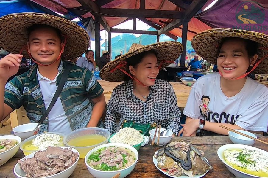
Apart from accommodation, the cuisine experience is also unmissable. Cuisine along the route features traditional northern Vietnamese dishes, including corn wine, local vegetables, and regional specialties like thắng cố (a traditional H’mong horse meat stew).
Street vendors and markets also provide tasty, quick bites. Plus, you can enjoy a dining experience in homestays. They can serve home-cooked meals for an authentic taste of local food culture.
In short, this balance of different accommodation types and culinary delights complements the experience mapped out on your Ha Giang loop Vietnam map.
Practical Travel Tips For The Ha Giang Loop
💡 Your safety goes first
- Safety is paramount when riding the Ha Giang Loop. Always wear a certified helmet, along with protective gear like gloves, knee and elbow pads, and sturdy shoes.
- Also, the mountainous roads are challenging, with sharp bends and occasional loose gravel. So, riding cautiously and alertly is essential.
- Avoid riding at night to prevent accidents due to poor visibility.
- Always honk before blind curves to alert other motorists, as this is a common local practice and helps avoid collisions.
💡 Prepare well for your transportation
- Choosing the right motorbike is important. It should preferably be a semi-automatic or manual bike with enough power for steep ascents.
- Scooters are not recommended.
- It’s also critical to practice riding on similar terrain before starting the loop, especially if you are inexperienced.
- Distribute your luggage evenly and avoid overloading to maintain balance.
- Travel insurance covering motorbike accidents is highly advised.
- Keep a list of nearby repair shops, as mechanical help along the loop is scarce.
💡 What to bring to Ha Giang loop trip
- Weather can change quickly in the mountains, so pack rain gear and warm clothing even if the forecast looks clear.
- Carry cash, as ATMs are few.
- Ensure your phone is charged with offline maps downloaded, since cell service may be patchy.
💡 Respect local customs and dress modestly when visiting ethnic villages. Planning your budget carefully can help you enjoy your trip without surprises, covering accommodations, food, and incidentals.
Ha Giang Loop Map FAQs
We recognize many travelers have questions before embarking on the Ha Giang Loop adventure. Here are answers to some of the most common:
❓ Is the Ha Giang Loop safe for beginners?
The loop can be challenging for inexperienced riders due to sharp bends, steep inclines, and variable road conditions. Beginners should consider guided tours or easy rider services to enhance safety and confidence.
❓ Can you do the loop without a guide?
Yes. Many choose to self-drive with a rented motorbike and a detailed Ha Giang loop tour map. However, local guides or easy riders offer valuable support, helping with navigation, local culture, and unforeseen situations.
❓ What to do in case of bad weather?
Mountain weather changes quickly. If caught in heavy rain or fog, it is best to stop at a safe place and wait. Carry waterproof gear and plan for extra time in your itinerary to accommodate weather delays.
❓ How to handle luggage on a motorbike trip?
Pack light and use waterproof bags or panniers securely strapped to your bike. Even distribution of weight helps maintain balance for safer riding.
❓ How busy is the loop during peak seasons?
The loop is busiest from September to November and March to May when the weather is best. Expect more tourists and book accommodations in advance. Off-peak times offer fewer crowds but may come with more unpredictable weather.
Conclusion
The Ha Giang Loop map guides you through an unforgettable journey of majestic mountain landscapes, rich cultural experiences, and thrilling rides. All itineraries, ranging from 3 days to 4 days or longer, the loop promises adventure and discovery in every corner.
Plan wisely, respect local customs, and prepare well for the conditions to make the most of your Ha Giang Loop Vietnam map experience. We invite you to explore the loop with confidence and curiosity, embracing the unique spirit of northern Vietnam.
If you need more detailed planning help or personalized advice, Ha Giang Private Car is here to assist you on your journey. We hope that our information and insights about the Ha Giang Loop map have assisted you in your travel plans. Thanks for reading.